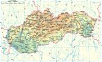
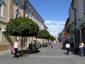
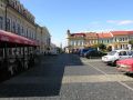
Rimavská Sobota is an administrative and economic center of the western part of the Gemer region. It is situated in the north-western part of the Rimavská Basin (Rimavská kotlina), divided by the river Rimava.
The area was inhabited already in the Later Stone Age (Eneolithic period). An extensive excavation and numerous findings of bronze objects dated from the Middle and Later Bronze Age were discovered in the area. The first written reference of the town comes from the year 1270. In 1334 it was owned by the Széchy family and during the years 1441-1460 it was occupied by the followers of Ján Jiskra, who built there a local fortress Sobôtka. Between 1554-1593 the city together with the fortress Sobôtka were occupied by the Turks and until 1686 paid the taxes to them. In 1784 Rimavská Sobota became a seat of the district administration.
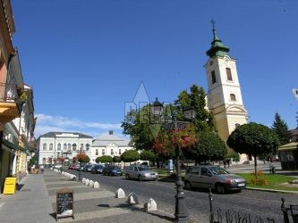
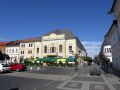
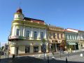
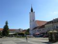
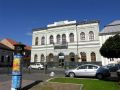
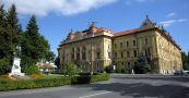
In the town there is a parsonage building which was built in 1775 in the late baroque style, a church from the year 1784, a neo-gothic tower from the end of the 19-th century, a chapel of Š. Ferenczyho from the year 1909, an administrative building from the year 1798 and a town-hall from the year 1801.